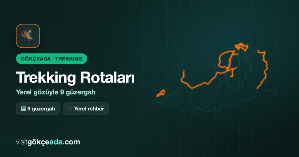
Gökçeada (Imbros) Trekking Routes: 9 Trails from a Local's Perspective
- 9 trekking routes on Gökçeada (Imbros) — most are unmarked, offline map essential
- Toughest route: Uğurlu–İsa Hill (~6 km, 3–4 hours, 673 m summit)
- Marmaros Waterfall only flows from December to May
- Gökçeada Ultra Trail 2026: June 6, categories 5K / 11K / 33K / 44K
- Best season: April–June and September–November
Heading out for an early morning walk on Gökçeada (Imbros) is a different kind of feeling. When you set off from the slopes of Uğurlu, the scent of wild thyme grabs you before you're even out of breath; then, when the sea appears mid-climb, you realize this route — though small on the map — has its own seriousness. As someone who's lived on the island for a long time, I can say this comfortably: most of the trails here still have no official markings, no signposts, and are left to their own devices. This is both proof of the island's untouched nature and a real risk for those who come unprepared.
Trekking on Gökçeada (Imbros): The Big Picture
Imbros is the largest island in the Northern Aegean. So even though distances between routes often look small on the map, the terrain can take serious time. The forested interior, ridges exposed to harsh northern winds, and steep coastal slopes each offer different conditions. The best period for trekking is April–June and September–November — in summer, the island's interior gets quite hot in the afternoon, and in winter, you might be surprised by snow at higher points.
One morning I noticed that the trail between Yıldız Cove and Mavi Cove had been badly damaged by last winter's rain and floodwaters. Asking a local source about current conditions before you start is especially important in spring.
- Definitely have an offline map app like GPS or Wikiloc with you
- Reliable water sources are only around the Marmaros valley
- Mobile signal is weak or nonexistent in the island's interior
- During the winter–spring transition, some cove roads may be impassable by car
- High-ankle boots recommended against wildlife (snakes, scorpions)
- Don't hike in the afternoon in midsummer — the sun is oppressive on exposed routes
Easy and Moderate Routes
If you're visiting for the first time or planning a family holiday, these routes won't ruin your day. They're also reasonable distances for those not used to long walks.
Yıldız Cove – Mavi Cove Walk
This route along the island's northern coast takes about 4 km, 1.5–2 hours. You walk along the shore from the remote sandy texture of Yıldız Cove to the rocky headland of Mavi Cove. The ground is slippery in rainy periods; after June, it's dry and hard. If you set out early in the morning, you might not see anyone at either cove — I've experienced this many times, and that silence is worth it on its own.
Marmaros Waterfall Route
The trail from Marmaros Village to the waterfall is about 3 km round trip, 1.5–2 hours. The waterfall is only active after winter and spring rains; if you go in midsummer, you'll find a dry bed. Finding the start of the trail from the village is a bit tricky — asking locals is the most practical way. You can find more detailed info about the waterfall and its surroundings in the Marmaros Waterfall guide.
Pınarbaşı – Tepeköy Altı Cove
This route descending from the interior to the coast is moderate difficulty. Starting from the Pınarbaşı area and finding the small cove below Tepeköy takes about 5 km, 2–2.5 hours. The descent is steep; your legs burn on the way back, but the cove's isolation is worth it. Definitely don't start in the afternoon in summer — the climb is in full sun.
Challenging Routes: Summits and Steep Coasts
These routes require physical fitness and preparation. But they also pay off handsomely in terms of scenery and experience.
Uğurlu – İsa Hill Climb
This route to Gökçeada's summit — 673-meter İsa Hill — is the toughest and most rewarding among the island's trekking routes. Starting from Uğurlu Village and reaching the summit takes about 6 km, 3–4 hours. On clear days, you can even see Samothrace Island from the top. In winter, snow occasionally falls around the summit — going with the wrong clothing is a serious risk. You can find more info about the Uğurlu area in the Uğurlu guide.
Radar Trail
This route to the old military radar station has started to be talked about in trekking communities in recent years. Since it passes along the island's high ridge, it offers wide panoramas, but there are no markers — GPS is mandatory. The surrounding old structures and barbed wire provide interesting details for photographers. The downside: in midsummer, there's zero shade on the ridge, and the wind can blow hard.
Gökçeada Ultra Trail 2026
The annual Gökçeada Ultra Trail will take place on June 6, 2026. There are four race categories: 5K, 11K, 33K, and 44K. The 44K category cuts across the island's challenging terrain from end to end and offers a serious mountain running experience. The island fills up quickly during the event week; early booking for accommodation is essential. Most of these routes can also be walked individually outside the race. For more activity options, check the Gökçeada activities page.
There's also a parking issue, frankly — the Uğurlu entrance gets clogged on race day. It's smarter to leave your car in the village and start on foot.
| Info | Details |
|---|---|
| Best season | April–June, September–November |
| Uğurlu – İsa Hill | ~6 km, 3–4 hours, hard, 673 m summit |
| Yıldız Cove – Mavi Cove | ~4 km, 1.5–2 hours, easy |
| Marmaros Waterfall | ~3 km round trip, easy-moderate, winter-spring |
| Pınarbaşı – Tepeköy Altı Cove | ~5 km, 2–2.5 hours, moderate |
| Radar Trail | Variable, GPS mandatory, moderate-hard |
| Ultra Trail 2026 | June 6, 5K / 11K / 33K / 44K |
| Recommended map app | Wikiloc or Maps.me (offline mode) |
| Guide needed | Recommended for challenging routes |
Frequently Asked Questions
Is a guide necessary for trekking on Gökçeada (Imbros)?
Not mandatory but recommended. There are very few officially marked trails on the island. For easy routes like Yıldız–Mavi Cove, an offline map may suffice; but for routes like İsa Hill or Radar Trail, going with a local guide increases safety and lets you cover the route much more efficiently.
What's the best season for trekking?
Spring — especially April and May — is the most suitable period. Flower-covered slopes, mild weather, active waterfall. September–November is also nice, but northern winds can be challenging on coastal routes. In summer, the interior is extremely hot; coastal routes are crowded and shadeless.
How do I register for the Gökçeada Ultra Trail?
Registration is done through the organization's official website. The 2026 date has been announced as June 6; categories are 5K, 11K, 33K, and 44K. Early booking for transportation and accommodation is critical — finding a place on the island becomes difficult during race week.
Can Marmaros Waterfall be seen in every season?
No. The waterfall is only active after winter rains — generally from mid-December to early May. If you go after June, you'll see a dry rocky bed and a beautiful valley, but no water. If you want to see the waterfall active, March–April is the most guaranteed period.
What should I wear for trekking on Gökçeada (Imbros)?
In spring, a thin rain jacket and layered clothing are essential. High-ankle boots or shoes are recommended against snakes and scorpions in the interior. In summer, bring sunscreen and plenty of water — there's no shade. For winter climbs, thermal base layers may be needed for İsa Hill.
📍 Marmaros — Harita
📍 Bu Bölgedeki İşletmeler
🍽️ Yeme & İçme
🏷️ Etiketler: